
By Kieran Westley
Background:
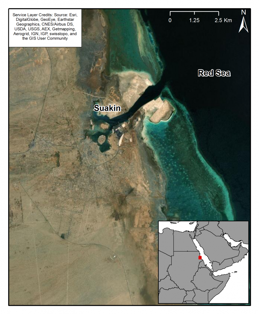
Suakin on Sudan’s Red Sea coast (Figure 1) remains one of the most enigmatic and iconic sites in eastern Sudan with many traditions and folk tales associated with it, embedding the place into the region’s psyche. Throughout much of the second millennium it was one of the region’s primary ports facilitating trade and the movement of peoples from Africa to the Gulf and further afield. One of the first reliable sources for the settlement at Suakin comes from the tenth-century geographer al-Mas’udi who referred to its population as belonging to the el Hassa Beja tribe and recorded that they were Muslim. He also made reference to the routes from the mines at Shenkir near the Nile to the ports of Suakin, Badi, and the Dahlak archipelago. In 1213 Yaqut described the ‘famous’ town of Suakin as a port to which came ships from Jeddah and described its inhabitants as Christian Buga. Ibn Battuta visited the town in 1330 and recorded that his ship ‘emerged at a roadstead called Ra’s Dawa’ir between Aydhab and Sawakin…….After two days’ travelling we reached the island of Sawakin [Suakin]. It is a large island lying about six miles off the coast and has neither water nor cereal crops nor trees. Water is brought to it in boats, and it has large reservoirs for collecting rainwater. The flesh of ostriches, gazelles and wild asses is to be had in it, and it has many goats together with milk and butter, which is exported to Mecca. Their cereal is jurjur, a kind of coarse grained millet, which is also exported to Mecca. The sultan of Sawakin when I was there was the Sharif Zayd, the son of the Emir of Mecca. We took ship at Sawakin for Yemen’ (Battuta 1958: II: 362-3).
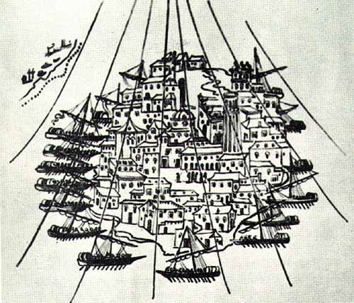
In the fifteenth century Suakin was the primary embarkation point for North African Muslims travelling to Mecca via the port of Jeddah, ruled by a Muslim sultan subject to King of Hamasen (near Asmara); simultaneously, it served as a departure point to Jerusalem for Christian Abyssinian pilgrims. By the century’s end the town was again under Egyptian Mamluk control, but became subsumed into the broader economic and cultural sphere of the Sennar-based Funj sultanate following its establishment in the opening decade of the sixteenth century. After the Portuguese failed to establish themselves in the Red Sea the town was temporarily surrendered to the Ottoman Turks in 1517, but appears to have retained a degree of autonomy. In 1541 de Castro described the town as lying ‘in the midst of a circular nook stands a flat island, almost perfectly round and level with the water, about a mile in compass. In this space there is not a foot of ground but what is taken up with houses; as that all the island is a city, and all the city an island’ (Figure 2).A second Ottoman expedition established Özdemir Pasha as the first governor of an Ottoman province of which Suakin was the capital in 1555, and a significant expansion of the port’s role developed over the following centuries. During the 1800s and early 1900s the port became a major focus of European activity as a result of British and French intervention in Egypt. Following the establishment of a deep-water port further north at Port Sudan in the 1930s the town was largely abandoned and many of its buildings rapidly fell into ruin. The mainland portion of the town (the Geyf) has recently undergone something of a resurgence as the regional government invests in the port to primarily facilitate the growing number of pilgrims sailing for the port of Jeddah in Saudi Arabia and onto Mecca.
In 2002 a group of researchers came together to initiate preliminary archaeological investigations at the site and to examine a range of conservation options. Archaeologists and architects from the Universities of Ulster, Cambridge, London (School of Oriental and African Studies) and Khartoum under the auspices of the National Corporation of Antiquities and Museums (NCAM) of Sudan and the London-based Mallinson architectural practice subsequently worked at the site for over a decade. The primary archaeological objective was to investigate the nature and extent of surviving archaeology on the site and to aid the limited building conservation that was focusing upon some of the last upstanding architectural remains.
Examples from the MarEA study
Overall shoreline change:
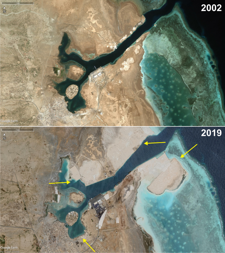
Suakin has seen extensive changes to its shoreline, most evidently on the outer parts of the approach channel, where extensive reclamation was carried out as part of the upgrade of the modern port facilities from the mid-2000s onwards. Whilst the historic core and island of Suakin have not been directly affected by these works, smaller-scale reclamation has also taken place southeast of the island from 2009 onwards, and north of Condenser Island from 2010 onwards (Figure 3).
Historic buildings
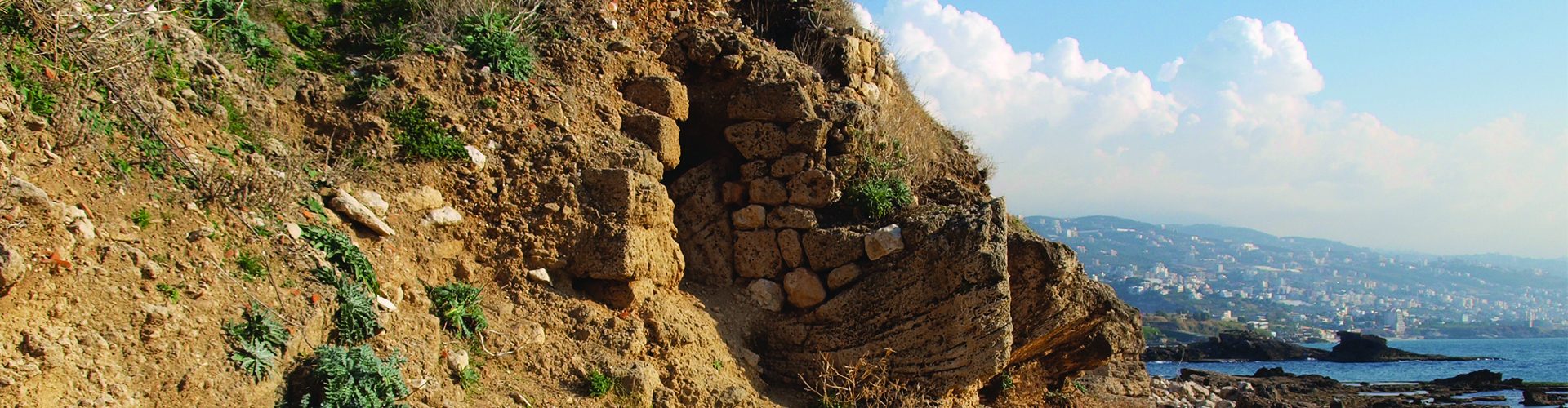
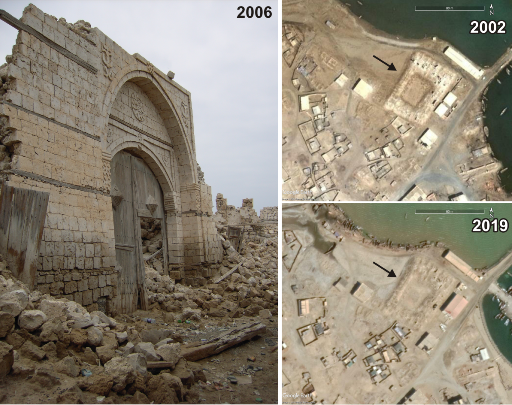
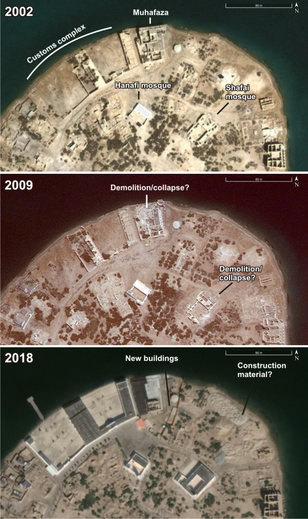
Suakin Island has been largely uninhabited since the 1930s, with the result that the majority of its historic coral block buildings now lie in ruins. One clear threat to the archaeological remains is therefore simply neglect, as shown by the collapse of the caravanserai entrance in 2010 (Figure 4). On the other hand, recent building work is also clearly evident on the island, as shown by the total reconstruction of the Customs Complex and the Hanafi and Shafai mosques, and appearance of other structures and construction material, presumably related to the reconstruction efforts, all of which are clearly visible on recent satellite images (Figure 5).
Port and harbour infrastructure
Prior to the British Colonial occupation, port and harbour facilities such as piers and moles were not used. Instead historic accounts suggest that vessels simply tied up to the quay encircling the island, bow first, thus giving them direct access to the merchants’ warehouses that lined the quay. Evidence of this earlier quay was discovered by excavations conducted in 2003 adjacent to the Customs complex. This identified a shore-parallel coral block quay wall which lies c. 6m inland of the modern shoreline and is believed to predate the mid-19th Century, possibly from as early as the 16th century. A later phase of quay construction during the Anglo-Egyptian period further extended the circumference of the island via a rubble, concrete and iron structure which roughly corresponds with the modern shoreline (Figure 6). The Colonial occupation also saw the construction of several piers and jetties around Condenser Island, with additional outlying piers on the mainland south of Suakin Island and north of Condenser Island (Figure 7). These were built predominantly for military reasons. Some of these structures, or at least their foundations, are still present, mostly clearly around Condenser Island, but a number of the outlying structures have either been removed or buried by recent reclamation (Figure 8).
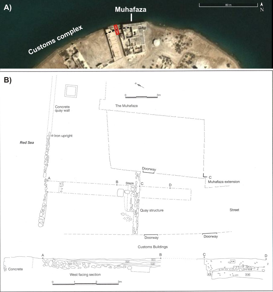
Figure 6. A) Google Earth image showing location of 2003 excavation trench (red box) as well as inferred line of the older quay (black dashed line). B) Plan and profile views of the excavation trench showing the two quay structures.
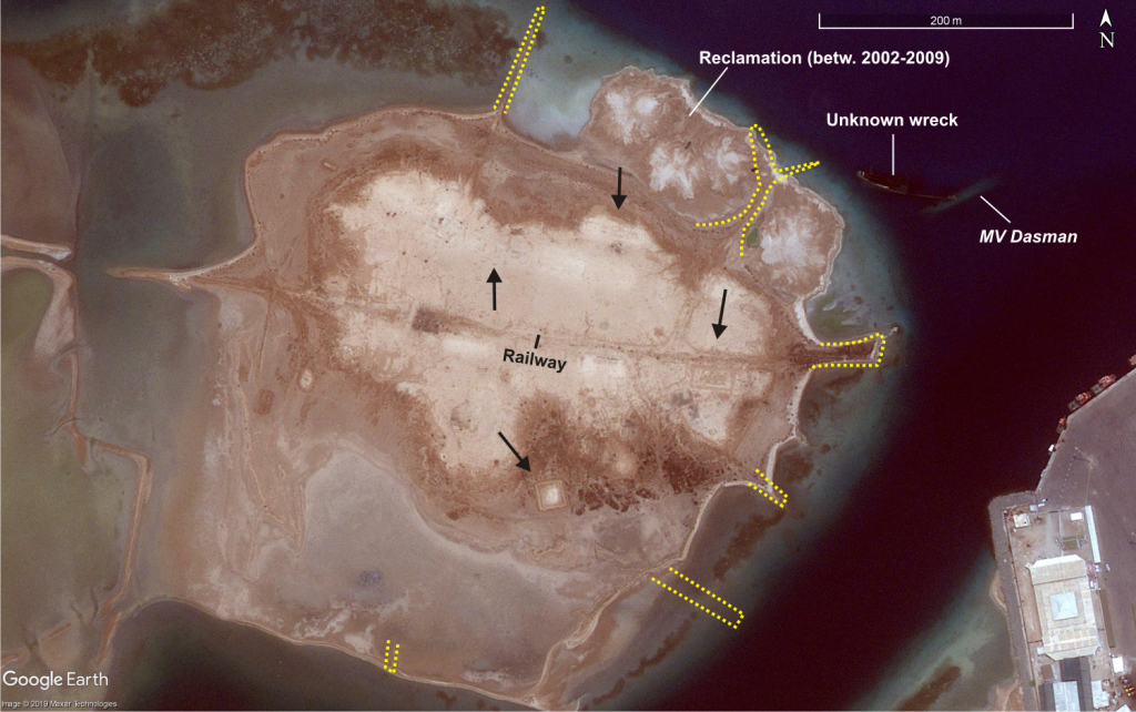
Figure 7. A) Google Earth image (19/8/2009) of Condenser Island. Note the location of Colonial-era piers/jetties surrounding the island (indicated by dashed yellow lines). In some cases the foundations of these still remain, in other cases, the remains are not visible. Note that the pier on the northeast of the island was subsumed by reclamation between 2002 and 2009. Also indicated are the railway, building foundations (black arrows) and two large metal shipwrecks in shallow water off the island.
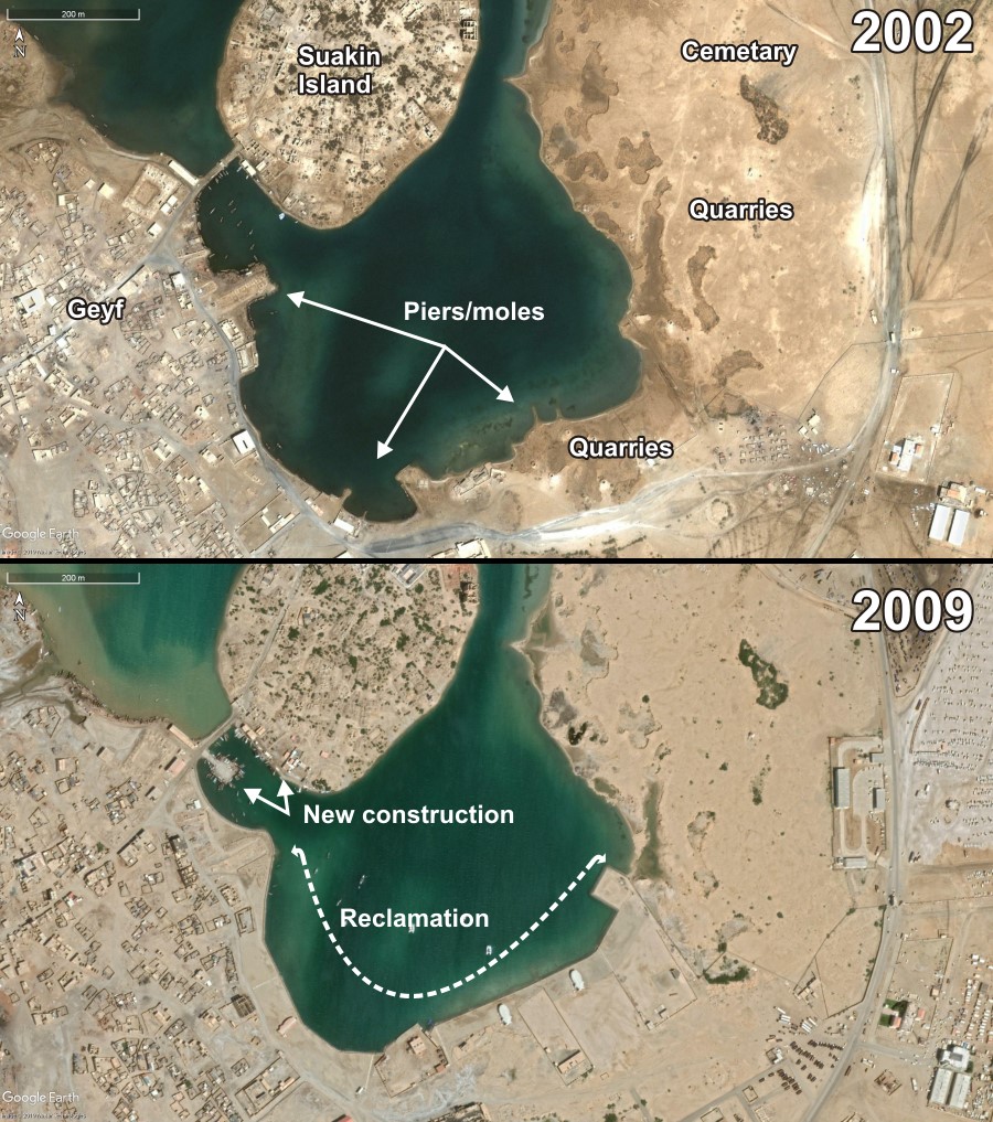
Figure 8. Comparison of Google Earth images from 2002 and 2019. Note in particular the loss of up to 5 piers/moles as they were subsumed by land which was reclaimed from 2009 onwards. Re-development associated with reclamation has also removed former quarries on the southeast side of the lagoon. Those further north remain largely unaffected as does an Islamic cemetery in this area. Note however the increasing encroachment of development on this area. Also evident are a new pier built onto the historic causeway linking the Geyf and Suakin Island, as well as some new construction on the southern shore of the island.
British Colonial-era defences
Given Suakin’s strategic importance, it served as Lord Kitchener’s headquarters during the Mahdi uprising of 1883-1898, and had its fortifications upgraded accordingly. Condenser Island became the centre of military operations, the remains of which are still visible today in the form of foundations for structures such as the hospital, water condensers and narrow gauge railway tracks, as well as the aforementioned piers protruding from its circumference. Suakin’s main inner defences comprised a wall (initially of earth, later upgraded to coral block and brick) connecting a series of forts surrounding the mainland core of Suakin – the Geyf (Figure 9). Outside this lay a further series of unconnected forts and redoubts. Today, the defensive wall is largely demolished with the exception of short upstanding sections around the Kitchener Gate (the main entrance to the town, and itself partly renovated) and low banks or soil marks on the southern and northern sides of the city. Similarly, many of the forts have also been destroyed or lie in disrepair. Nevertheless, some are still clearly evident on recent satellite images, including two forts on the inner wall, at least three of the outlying forts, and various low mounds or soil marks which could mark the former footprint of demolished forts or redoubts (Figure 10).
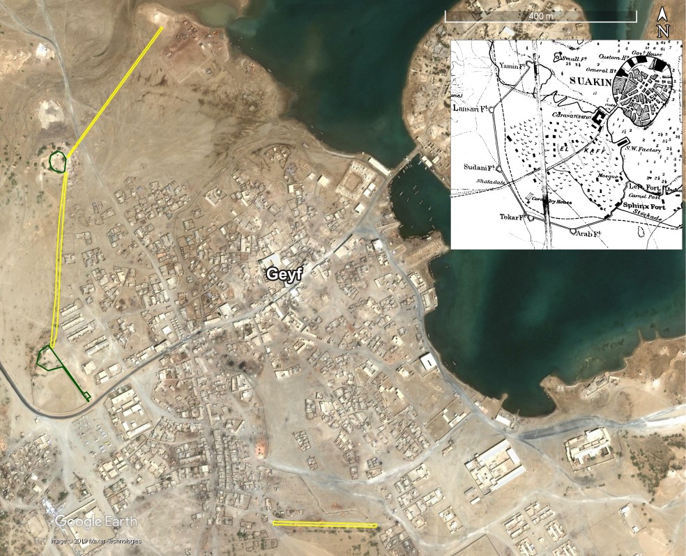
Figure 9. Remains of Suakin’s inner defences with standing remains indicated in green, and ephemeral remains (e.g. low banks, soil marks) indicated in yellow. Inset shows a late 19th Century map which depicts Suakin’s inner defences at that time.
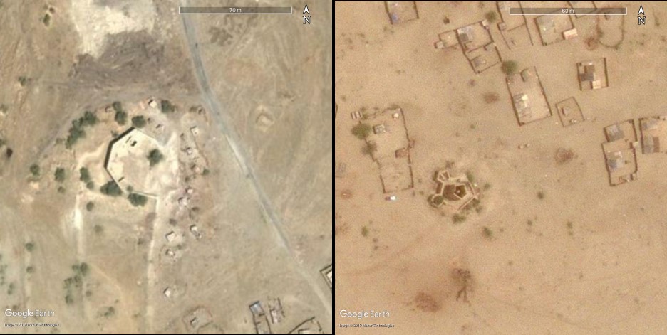
Figure 10. Google Earth images showing examples of fortificaitons which are still upstanding. Left) Lansari Fort, part of the inner walled defences. Right) Handub Fort, part of the outer connected defences.
Shipwrecks
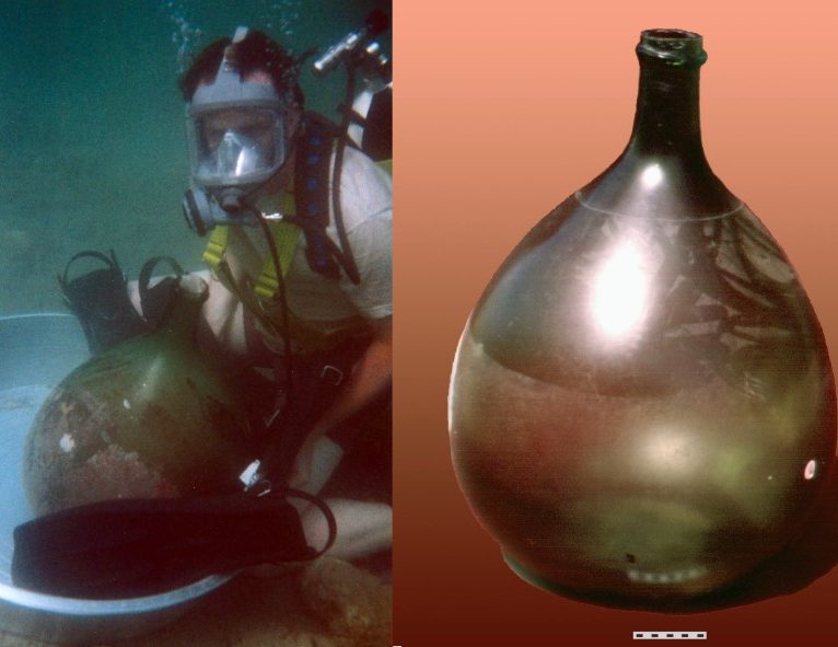
To date, underwater archaeological investigation has been limited to a few dive surveys conducted off Suakin Island. However, even these have identified a range of debris relating to quay construction and use, including an intact glass bottle likely dating to the late 19th Century (Figure 11).Close inspection ofrecent satellite imagery along with historic aerial photos has also allowed the identification of a number of shipwrecks within the lagoon harbour. The most obvious are two large metal wrecks which lie in shallow water just off Condenser Island (Figure 12). Records from UK Hydrographic Office and the wrecksite.eu database indicate that one is the MV Dasman, a passenger ferry built in 1931 which caught fire and sank at her moorings in November 1970. However, the name and origins of the second large wreck, which appears to lie partly under the Dasman, are unknown. Two smaller more ephemeral wrecks are also visible off southeast Condenser Island – one of which predates the 1930s as it is also visible on a historic aerial image – with the faint outline of a third small wreck sometimes visible off the mainland shore east of Suakin Island.
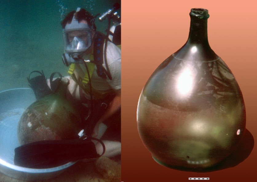
Figure 11. Intact 19th Century glass jar recovered by an underwater archaeological survey in the lagoon off Suakin Island.
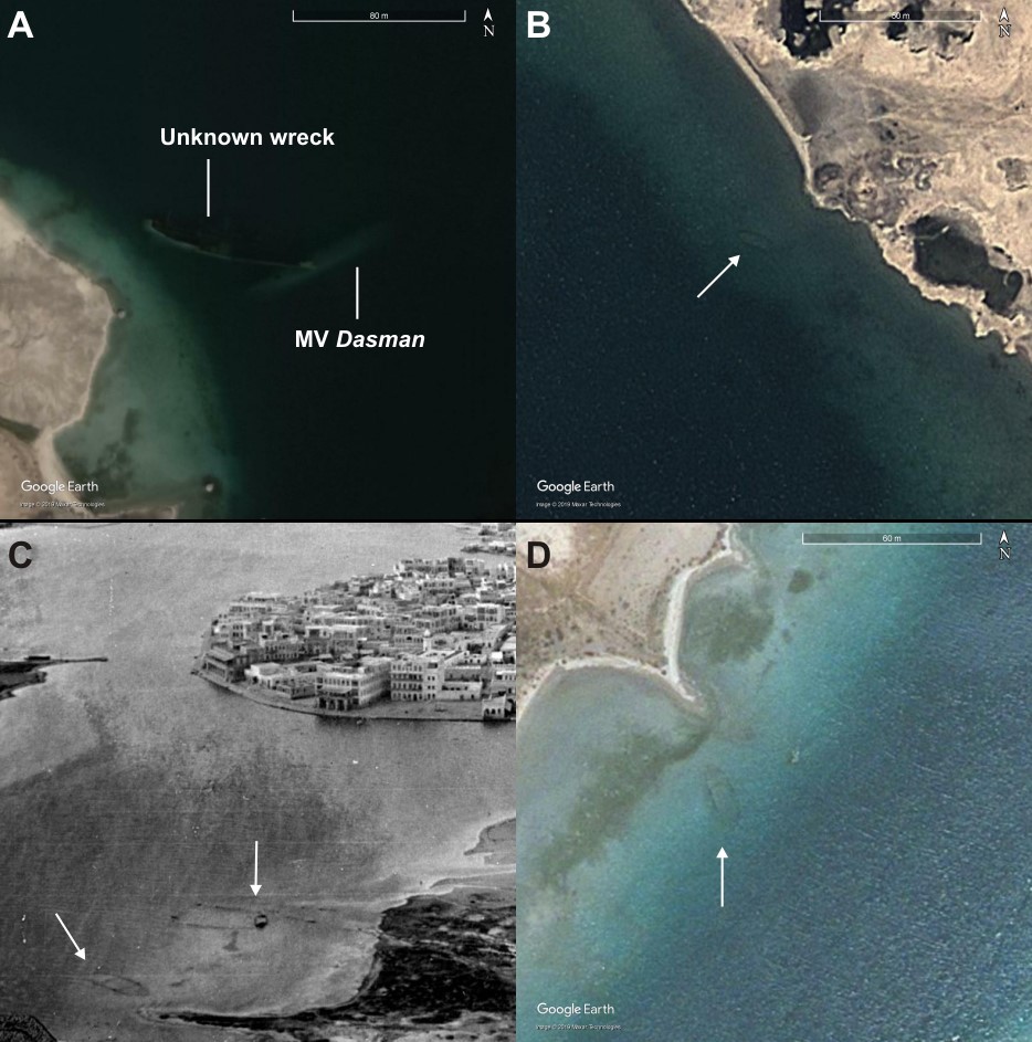
Figure 12. Wrecks in Suakin lagoon. A) Wreck of the MV Dasman and another unidentified metal ship off northeast Condenser Island (Google Earth Image: 2018). B) Faint oval outline suggestive of a small submerged wreck located east of Suakin Island (Google Earth Image: 2010). C) Historic (1930s) oblique aerial photo looking to the southeast over Suakin Island with the southeast shore of Condenser Island in the foreground. Note the two wrecks located on the foreshore/in shallow water off Condenser Island. D) The larger of the two aforementioned wrecks is still faintly visible on Google Earth imagery (date: 2009).