Sayantani Neogi
For over 5,000 years, the ancient port city of Tyre has stood as a majestic testament to human civilisation. Once a roaring Phoenician maritime capital that birthed great colonies across the Mediterranean, the city has weathered countless empires—its enduring stone arches, Roman hippodrome, and imperial necropolises still standing. In recent months, however, this irreplaceable UNESCO World Heritage Site has faced an existential threat from modern warfare.
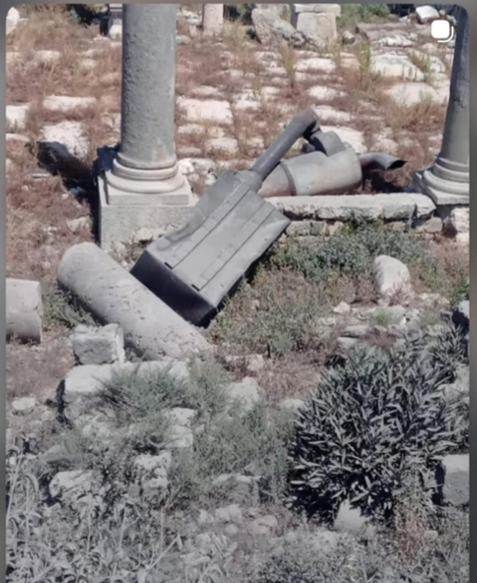
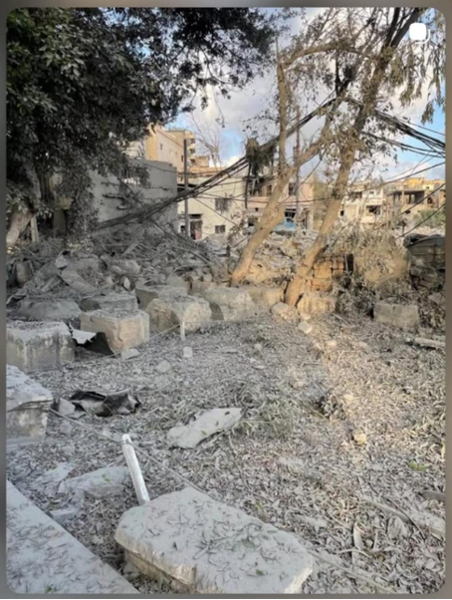
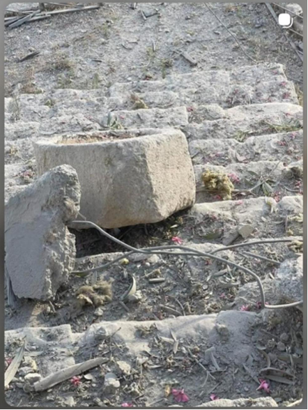
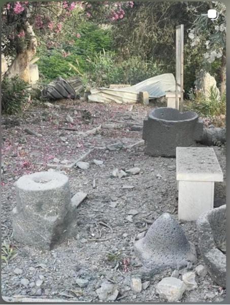
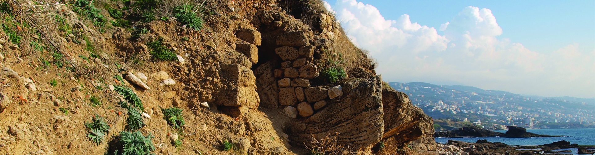
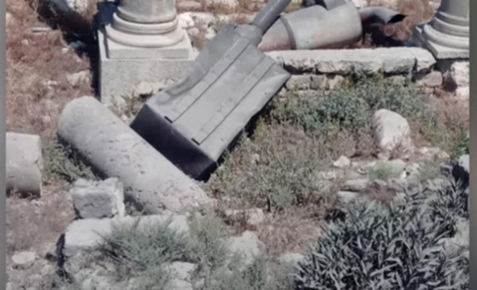
Media imagery, along with specific photos published by the Lebanese Ministry of Culture through their Instagram handle, offers a painful view of the reality on the ground. Airstrikes directly adjacent to the historic “City Site” have sent shockwaves through the structural integrity of the ruins. Broken ancient blocks and blast debris rest haphazardly among modern wires, capturing a jarring clash between centuries-old craftsmanship and immediate devastation. Tragically, the physical trauma includes a truncated Roman column, its heavy architectural crown—the capital—sheared off by the kinetic force of a nearby explosion (Figs 1, 2, 3 and 4). Reports from ICOMOS Lebanon and other local authorities confirm that these detonations have severely damaged administrative sectors, archaeological warehouses, and entrance gates, fracturing invaluable Roman and Byzantine mosaics embedded in the courtyard floor. This widespread destruction severely threatens the foundations of the ancient property, which only recently received “Enhanced Protection” status under the 1954 Hague Convention.
A Widespread Threat to Cultural Identity
The danger to Lebanon’s identity is not isolated to a single site. Across southern regions, the country’s historic fabric is fracturing under relentless military activity. The revered Mamluk-era souks of Nabatieh have been heavily pulverised, and entire border villages containing decades of collective memory have been fundamentally flattened. Further alerts are also tracking the unstable surroundings of the iconic Crusader-era Beaufort Castle.
When conflict shatters archaeological landscapes, it does not just destroy rock; it chips away the shared global story of humanity. Safeguarding these monuments is not an afterthought—it is a binding humanitarian and cultural obligation. When conflict threatens a nation, the immediate and undeniable priority is the preservation of human life. Yet, close behind lies a secondary, silent casualty: collective memory. Cultural heritage sites are not merely static arrangements of stone, mortar, and concrete; they are the physical anchors of a society’s identity, continuity, and future resilience. To destroy them is to erase the tangible evidence of a people’s history.
This is why, for heritage professionals, documentation during times of crisis is not a passive academic exercise—it is an active act of resistance. Comprehensive archiving serves as an insurance policy for civilisation. If a monument is structurally compromised or levelled, meticulous records ensure its architectural DNA survives, providing the precise blueprints required for future restoration and recovery.
In active conflict zones where physical access is dangerous or impossible, remote sensing documentation has emerged as a revolutionary tool for heritage protection. Utilising satellite imagery, high-resolution aerial photography, drone-based LiDAR, and 3D geospatial mapping, international experts can monitor vulnerable landmarks from afar. These remote tools allow conservators to conduct rapid damage assessments, detect illicit excavations, and track structural decay in real time, without putting lives at risk. By creating permanent, unalterable digital twins of endangered sites, remote sensing ensures that even if physical structures are fractured, their data remains intact, verifiable, and ready for the day rebuilding begins.
However, these remote sensing observations are only as powerful as the digital infrastructure built to hold them. This is where the central role of dedicated cultural heritage databases becomes critical. The MarEA (https://marea.soton.ac.uk/) project uses identical data pipelines to channel its highly specialised coastal, nearshore, and maritime threat assessments directly into the shared EAMENA spatial database framework. This ensures that the documentation for a port city like Tyre seamlessly combines both its dry-land archaeology and its submerged maritime landscape in one single repository.
By securing these permanent, unalterable digital twins, remote sensing does more than just archive the past—it safeguards the future. It ensures that even if physical structures are damaged today, their data remains intact, verifiable, and centralised, holding the ground ready for the day when rebuilding can finally begin.