On the northeastern coast of Libya, where the forested uplands of the Djebel Akhdar meet the Mediterranean Sea, lies one of Libya’s most important protected areas: El Kouf National Park. It is situated in western Cyrenaica and was Libya’s first designated natural reserve, formally established as a National Park in 1979.
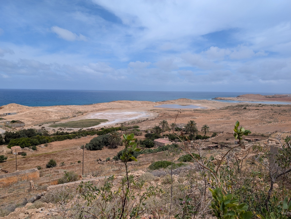
The park’s coastline is a designated Marine Protected Area (MPA) and shelters a diverse array of marine and terrestrial wildlife across three distinct eco-zones, and its waters are home to many endangered species; bottlenose dolphins, nesting loggerhead sea turtles, and the critically endangered Mediterranean monk seal have all been recorded here. Yet El Kouf is equally a landscape of long human occupation. Evidence includes prehistoric caves, Greek and Roman-period settlements, and more-recent Ottoman and Italian colonial buildings. Among the most significant are the ancient harbour settlements of Al-Ogla and Al-Haniyah, alongside Roman-period farmsteads and Greek-period watchtowers. These sites are evidence of the existence of a long human relationship with the rich natural marine and coastal environment: people fishing in the sea, hunting in the sebkhas (salt marshes), and practicing agriculture on the fertile coastal plane, while also taking advantage of the small natural coves that formed the harbours from the Archaic period onwards. Natural and cultural heritage are clearly intertwined, and both face the same natural and anthropogenic threats.
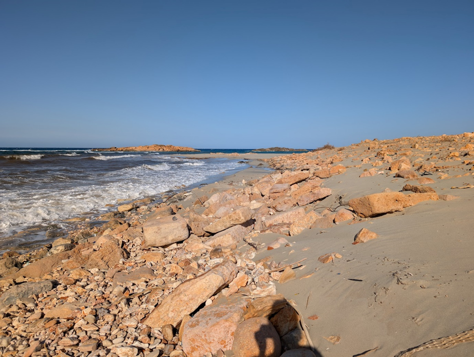
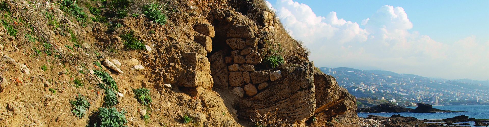
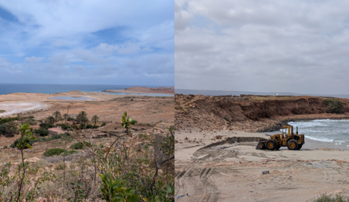
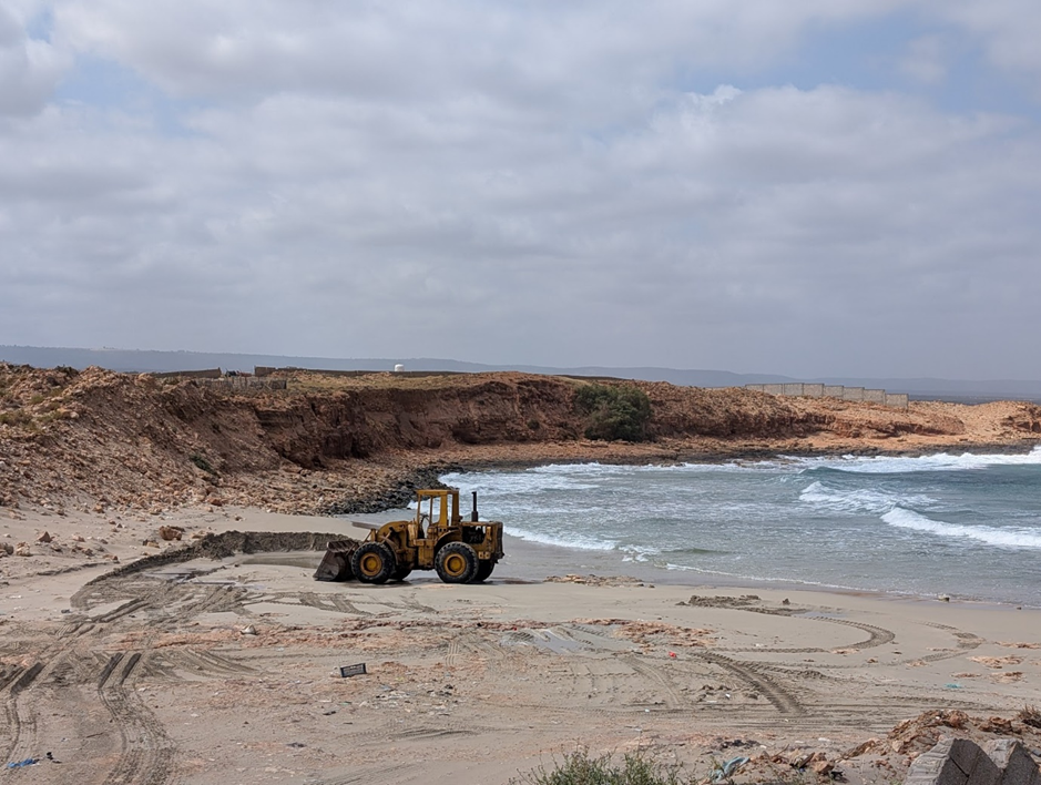
These threats are severe and accelerating. Coastal erosion, intensified by winter storm surges, is actively collapsing cliff sections at Al Haniyah that contain irreplaceable archaeological evidence. Beach sand mining along the coast destabilises bay sediments and strips away the natural buffers that might otherwise slow that process, and destroys breeding and resting grounds for sea turtles, birds and seals. Unregulated construction and agricultural expansion have already destroyed ancient remains as well as important habitats. Since the civil unrest that followed the Arab Spring in 2011, heritage professionals and authorities have struggled to safeguard heritage and natural sites across the country, as the policies and laws were no longer enforced. Along the El Kouf coastline, the result has been a race between destruction and documentation that heritage professionals and ecologists are, in many places, losing.
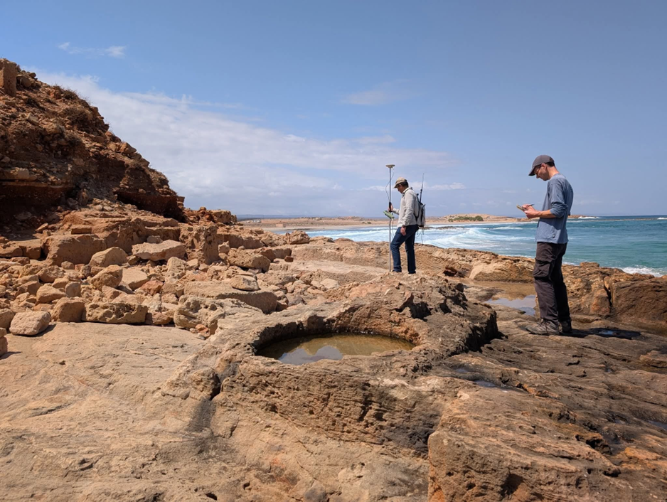
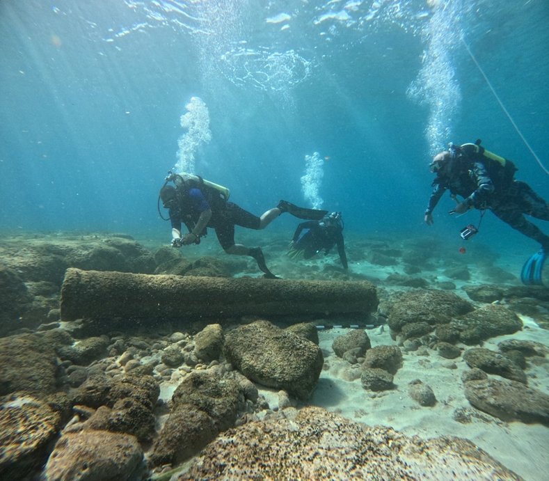
It is within this context that MarEA, together with University of Benghazi and the Department of Antiquities, has been documenting sites along this stretch of coastline. The Cyrenaica Coastal Survey, developed as a collaboration between MarEA, the Department of Antiquities, and the Universities of Al Bayda and Benghazi, set out to record the current condition of maritime heritage along this coast, with particular attention to the smaller, lesser-studied harbour sites consistently overshadowed by the major classical centres of Apollonia, Tocra and Ptolemais. The situation has become critical at Al Haniyah, a harbour settlement that was in use for over a thousand years, from the sixth century BCE into Late Antiquity. In 2025 we completed an emergency documentation project at the site, responding to damage already caused by erosion, agricultural encroachment, and infrastructure expansion. Working on land and underwater, the team recorded seventy-six walls within a single 120-metre cliff section, pottery sequences spanning over a millennium, a fortified multi-phase building, industrial installations, and underwater harbour infrastructure including stone anchors and a probable breakwater. In the winter of 2025/2026, more of Al-Haniyah’s cliff collapsed into the sea.
In 2026, MarEA, together with the University of Benghazi, will now start to work towards an integrated approach to document and protect both, natural and cultural heritage along El-Kouf’s MPA. The aim is to demonstrate that not only do both share the same space, but also the same vulnerability, and to start to develop methodologies that will help to protect the human and natural world under the same framework.
The 2025 field project and training at Al Haniyah were funded by The British Council’s Cultural Protection Fund, BILNAS and ASOR. We are grateful for their support.